 SANDS Visual: Designed for visual surveys where an operator takes images with a handheld camera and uploads real-time reports.
 SANDS Imaging: Designed for visual surveys with an automated nadir-viewing high-resolution camera(s) mounted in the aircraft.
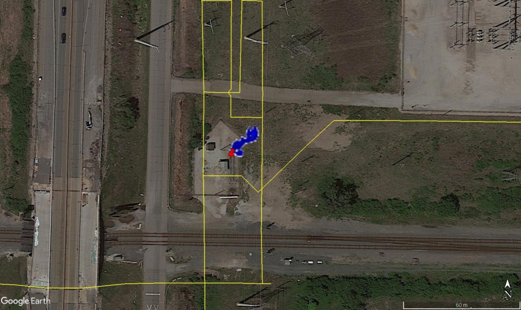 SANDS Sensing: Designed for imaging of leaked natural gas plumes and high-resolution visual imaging of pipelines.